New Zealand Aotearoa Pathfinder Map 108
- ISBN #9415871000300
- PATHFINDER
- Ships in 3-10 days
- Ships in 3-10 days
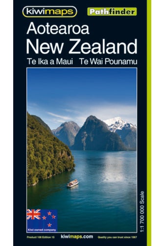
New Zealand Aotearoa Pathfinder Map 108
- ISBN #9415871000300
- PATHFINDER
- Ships in 3-10 days
- Ships in 3-10 days
$10.43 ex GST
- Product Details
- Delivery & Returns
-
New Zealand at 1:7,000,000 from Kiwimaps on a single-sided, indexed map with enlargements of environs of main cities, traveling times, distance tables, and indexes for national parks, mountains, rivers, lakes, etc. as well as towns and villages. The road network highlights state highways and indicates tourist routes such as the Pacific Coast Highway, Thermal Explorer Highway, Alpine Pacific Triangle Route, etc. The base map has relief shading to show the topography, with plenty of names of mountain ranges, lakes and other geographical features. National Parks and protected areas are highlighted. The index on the reverse provides separate lists of cities/towns/localities, mountains/parks/ski fields/tracks, and rivers/lakes/bays.
- Publication Date: 01/11/1999
- 880 x 615mm
- Sheet Map, folded
-
There is no Handling & Delivery cost for orders over $50 ex GST unless there are large items in your order.
Orders under $50 (ex GST) & excluding Gift Card only orders :
$6.00 ex GST ($6.90 incl GST)
Surcharge for Rural Delivery addresses $3.13 ex GST ($3.60 incl GST) for orders under $50 ex GST
Orders with only Gift cards under $50 are charged $2.52 ex GST ($2.90 incl GST)There is no Handling & Delivery cost for eGift card orders.
Charges for Large or Bulky items . These are indicated by the Large item icon.
Regardless of total order value: first unit $8.70 ex GST ( $10 incl GST), then every subsequent unit $4.35 ex GST ($5 incl GST)Read more about Delivery Information
Read our Returns and Exchanges Policy
-
Product Details
New Zealand at 1:7,000,000 from Kiwimaps on a single-sided, indexed map with enlargements of environs of main cities, traveling times, distance tables, and indexes for national parks, mountains, rivers, lakes, etc. as well as towns and villages. The road network highlights state highways and indicates tourist routes such as the Pacific Coast Highway, Thermal Explorer Highway, Alpine Pacific Triangle Route, etc. The base map has relief shading to show the topography, with plenty of names of mountain ranges, lakes and other geographical features. National Parks and protected areas are highlighted. The index on the reverse provides separate lists of cities/towns/localities, mountains/parks/ski fields/tracks, and rivers/lakes/bays.
- Publication Date: 01/11/1999
- 880 x 615mm
- Sheet Map, folded
- Delivery & Returns


